(Sub-)millimeter resolution for water-side dam surveys
With a UAS-mounted, metric medium-format camera, Orthodrone achieved (sub-)millimeter resolution for photogrammetric surveys of two water-side dam faces in the Swiss Alps
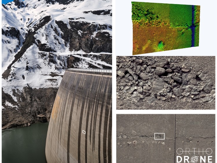
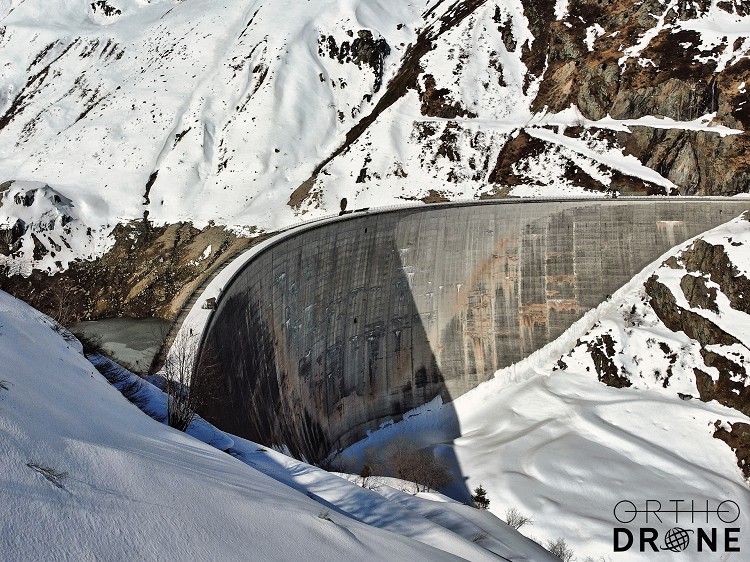
With our team and equipment packed tightly into the gondola, Orthodrone ascended through the awe-inspiring scenery of the Swiss Alps blanketed in white. The first dam was unreachable any other way, and it was obvious why, once we saw the road markers barely peeking out from under meters of snow. At this time, the reservoir levels were at their lowest and our mission was to complete two UAS-based photogrammetric dam surveys delivering data with (sub-)millimeter resolution.
While dams constitute critical infrastructure and contribute to economic development and social welfare, they can also pose potential hazards to life, property, and the environment. Throughout a dam’s lifetime, appropriate operation and consistent maintenance are paramount to minimizing risk. Regular monitoring helps to ensure that dam infrastructure is functioning properly. Conventional dam inspections required resource-intensive, manual data collection by workers atop platforms suspended from the dam. In the last few years, UAS-based photogrammetric dam surveys have become the preferred method of inspection due to their increased safety and efficiency.
Drone inspection solutions offer safer aerial access to challenging areas, increased productivity and cost-effectiveness. Our tool for the job is a fully integrated metric medium-format camera, which offers extremely detailed ultra-high-resolution imagery with an exceptional pixel count. This translates to larger footprints, which means more area per image and less flight time for UAS-based photogrammetric dam surveys. While other cameras found on common consumer-grade drones generally allow for a shutter interval of one image per one or two seconds, the medium-format metric system can shoot three frames per second. When embedded on our fully electric and gas-hybrid multirotor drones, we can fly faster, farther, and capture more data.
With this setup, we can achieve a 1.5 mm ground sampling distance (GSD) with a footprint larger than 17.5 m x 13 m, hovering at about 32 m or 60 m away from the dam face (depending on the lens). A 1 mm GSD (footprint greater than 11.5 m x 8.5 m) is possible at a distance of up to 40 m, whereas a 0.5 mm GSD (footprint greater than 5.8 m x 4.4 m) can be attained up to 20 m away from the dam wall. With these specifications, significantly less photos, flight lines, and flight time are required to capture the same area that other well-known full-frame systems need several days for. Vastly outperforming the competition in quality and efficiency, this metric medium-format system integrated with one of our upcoming gas-hybrid UAS is an ideal tool for infrastructure inspection, surveying, and mapping.
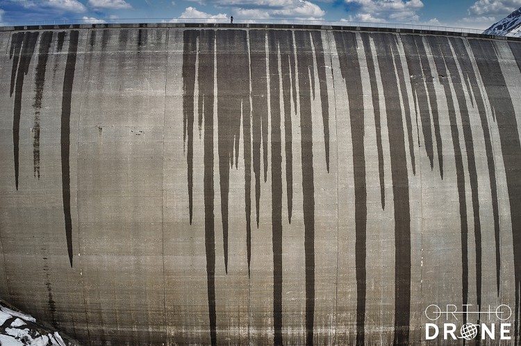
While utilizing a cutting-edge industrial camera considerably enhances productivity, added automation through range finders and real-time kinematic GNSS eases the job. Aiding with flight control and injecting a spatial data stream directly into the camera simplifies not only post processing, but allows for sharper images with LiDAR-based autofocus. This is particularly important due to the generally convex shape of dams, posing challenges for pilots and their spotters, especially when flying in gusty conditions. Of the two dams surveyed, one dam was 127 m in height with a crest length of 480 m, while the other had a height of 117 m with a crest length of 560 m. Such areas require terabytes of data storage for the desired (sub-)millimeter resolution of the images, making good use of our onboard processing units for significantly larger data storage.
With the gathered images and derived multidimensional deliverables, the dam face is then assessed for abnormalities or degradation – even minuscule cracks can be detected. Quality data is essential for a thorough assessment of structural integrity. Such fine detail helps enable inspectors to identify areas of concern which are then properly addressed to mitigate risks before they can progress into potentially more costly and dangerous issues.
Orthodrone is your reliable partner for critical infrastructure inspections – including sub-millimeter photogrammetric dam surveys in hard-to-reach areas. Visit our booth for an in-depth insight of past projects, current research, and the introduction of our new and fully offshore capable gas-hybrid multirotor UAS. With hours of hover time and top of the line sensors, we are looking forward to revolutionizing the way you gather, process and utilize spatial data!
Company Name: Orthodrone
Visit: https://www.orthodrone.com
LINKEDIN: https://www.linkedin.com/company/orthodrone
FACEBOOK: https://www.facebook.com/OrthodroneGmbH/
INSTAGRAM: https://www.instagram.com/orthodrone_gmbh/